You cannot understand transportation trends without understanding traffic movements. The accurate measurement of traffic including timely traffic counts is paramount to effective decision making. Unfortunately, traffic count technology is lagging behind.
Why Do Governments Count Traffic?
Counting traffic is vital for local and national governments to make informed decisions about mobility, infrastructure and taxation. This information is used to better understand the present and prepare for the future. There are also several mundane reasons why getting an accurate traffic count is important.
In the US for example, local governments need data on traffic in order to report to the Highway Performance Monitoring System (HPMS) – a national report that each state must submit to the Federal Highway Administration. Traffic count data is used by stakeholders to make smart decisions focusing on road maintenance, for example resurfacing or improving highways. Amazingly, there are only about 500 counting stations across the entire US. These decisions form the basis according to which the federal government allocates budgets to local governments to support infrastructure work. Accurate data has the potential to translate into budgets.
Similar reporting may be required by different levels of government and task forces. Government and municipalities may be best served with the use of an accurate and easy method of traffic counting. COVID-19, for example, is noted as the cause of a 30% drop in fuel tax receipts as a result of fewer vehicles on the road additional reductions in collected taxes may be due to EV adoption. Governments need to understand where was drops in traffic volume occur to better plan for flucuations in tax payments and shifts in infrastructure, and maintenance needs.
What Information is Gathered Using Traffic Counts?
When you hear about traffic counting, there are a few common terms that come up time and time again.
Let’s look at some of the most common terms and what they mean.
- Vehicle Miles Travelled / Vehicle Kilometres Travelled: Shortened to VMT or VKT. At its simplest, this is a measure of what distance was travelled using vehicles overall and is calculated by multiplying the amount of daily traffic on a roadway segment by the length of the segment, then summing all the segments’ VMT or VKT for a given period of time. Total VMT or VKT gives a measure of the demand for vehicular transportation and can be used to estimate its environmental impact. In order to get a better understanding of this impact, some modern VMTs take into account the vehicle type (expressed as a multiplier).
- Average Annual Daily Traffic: AADT is usually where government compliance is focused, and this measures a load of traffic on a specific road segment. How many vehicles drive on this part of the road, on average, over a given period of time. This metric provides information on how busy a specific road is, and is a good indicator for wear-and-tear and for problematic roads whether changes like an additional lane or smart signage can be implemented.
- The K Factor: Averages can be misleading, and it is often more important to know what happens during the peak hour of traffic on any given road. This is calculated as a proportion of the AADT that’s happening in a single hour, and usually uses the 30th highest hour of traffic in a year. This is used to understand what the impact of a change will be, such as closing a lane, adding traffic lights, or other signals, as well as to estimate congestion.

Traffic Counting in Action – How is it Practically Done?
There are several ways in which stakeholders can count traffic. Some provide a continuous count that offers 24/7 monitoring, and others are short-term measurement projects taking a snapshot for a set time frame (for example 48 hours) and the extrapolate it.
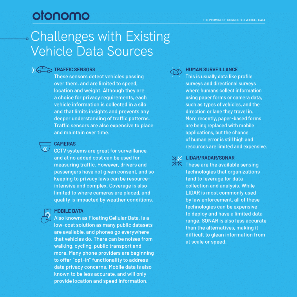
Traditionally, sensor technology has been used to gather traffic information – inductive loops and magnetometers, or induction coils in the road. These are limited in the data that they gather, focusing on speed and location. Of course, they can only gather information about a sample that is at their location.
Off-road technologies have also been used with radar or infrared cameras to gather information about cars as they pass. There are also digital camera solutions, although these can be costly to implement. These solutions are less disruptive to implement, but they still have the issue of gaps in coverage and insight.
A more holistic approach is to utilize the vehicles themselves, which are increasingly connected. A recent survey shows that already 62% of smart city decision makers already use vehicle data, and that number is set to grow. Vehicles today transmit a growing amount of data, and it makes sense to utilize this to provide an accurate, timely, and continuous count of traffic. One that covers every and any road, and at a fraction of current costs.

Connected vehicles are a better source of data for VMT providing real rather than extrapolated data and allowing data to be enriched with multi-layered data. Instead of assuming a K factor based on a year’s worth of historical data – connected vehicles can share information in real-time that provides an accurate picture of current events, and the impact of any change. Vehicles can share information on congestion, location, end-to-end journey time, braking, weather, and more – and all without any infrastructure costs whatsoever, ensuring zero gaps in visibility.
Looking to learn more about how connected vehicle data can be used to measure traffic? talk to one of our data experts.


More Stories
Professional vs. DIY Tinting: What You Should Know
New updated edition of “PXIMate” reference guide for T&M engineers available from Pickering Interfaces
5 Mistakes That Can Ruin Your Car Accident Claim