There has not been so much disruption in global and local supply chains in the lifetime of most logistics specialists than there is at present.
Following closely behind the closure of ports and borders in response to the Covid-19 pandemic has come disruptions due to increasingly violent and frequent
storms, Russia’s invasion of Ukraine and sporadic port closures in China as it continues with Covid lockdowns.
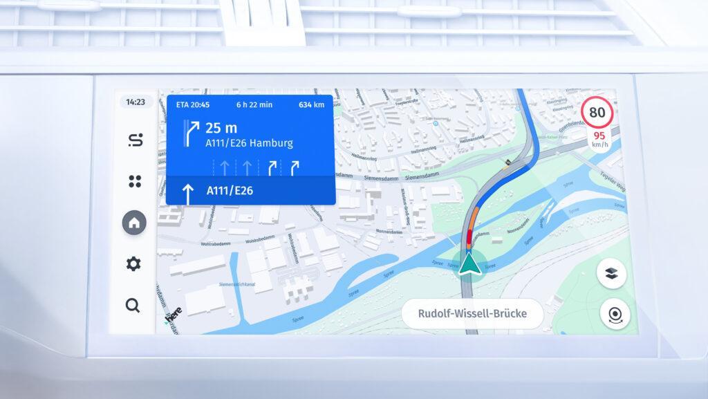
At a local level, fleet managers need to know what road conditions are in real time, or when a toll road is faster or more efficient than the alternative. Location data is making this more seamless with improvements in vehicle tracking and live map updates which allow seamless tracking of all assets – both within company premises and on the road.
Automotive Industries (AI) asked Remco Timmer, Vice President, Product Management at HERE Technologies, how can companie

s withstand future shocks such as the current supply chain crisis.
Timmer: Companies have realized that being wholly dependent on global supply chains is a business risk.
They are rethinking their global orientation.
Governments and politicians are also pursuing localization aggressively. In Europe and the United States there are a number of initiatives to bring critical parts of infrastructure closer to home.
That is one way we are going to withstand future shocks, and be a bit more agile, and a bit more resilient.
To support supply chain crises, HERE is providing dynamic location data that provides an understanding of global mobility and logistics, in order to help clients plan and redesign their local and global logistics systems.
It is all about transparency and visibility. And this is where location technology with automated tracking capabilities comes into play by making it possible to predict and adapt to problems in real time.
AI: How does HERE’s supply chain solutions provide this support?
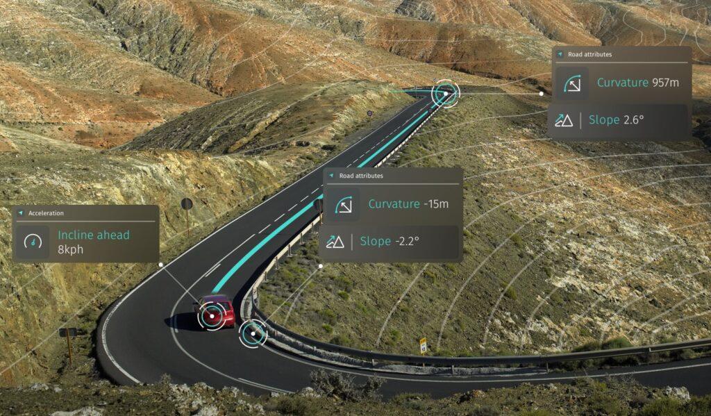
Timmer: At the very core of what we do is provide a digital representation of reality, with dynamic data such as traffic and weather on top of the map. Using that data, we can create optimized routes and enable delivery vehicles to be guided on those routes while continuing to track them.

You have to adapt continuously to life events. Location Services allow our customers to change the planning in real time, and also inform drivers to adjust course. Location intelligence improves the utilization of your assets, and also the distribution of your assets over your operating area. It also helps reduce your carbon footprint.
AI: Where does the supply chain start for HERE?
Timmer: We can optimize the use of assets on the public road, and in the likes of private yards, indoor environments, distribution centers and last mile warehouses. This allows end-to-end planning from inside the yard to the drop-off point in another private facility.
You can do this for your suppliers as well as your own fleet and staff. You do not want suppliers to be stuck not knowing which entry or exit to use, and whilst waiting clog up your operations.
Our customers are using the intelligence to plan logistics around the needs of their businesses rather than the usual routes. The system allows them to use their local insights in their planning, which makes them more resilient and more effective.
AI: How important is it to invest early in supply chain technology?
Timmer: It is really critical that customers come to us early so we can co-create solutions that really suit their business.
We work with them to see what it is that they can do versus what it is they would rely on us to do. Geospatial information systems are not new to supply chain operators, but real-time geospatial information is still quite new to some.
AI: What other digital initiatives finance supply chain agility?
Timmer: If you look at the core tech trends that are really changing and impacting supply chains, currently, it is all about IoT (Internet of Things) connectivity. Sensors are becoming more advanced; the footprint of devices is getting smaller and there is more data to analyze. Some of the compute models that used to only run on the cloud side are moving to the edge in order to handle the volumes of data.
There is an immediate impact on overall planning and efficiency. With always-on connectivity the data can be aggregated and processed for all kinds of additional analysis in real time. There’s real responsiveness in a system, which brings agility.
AI: What will be the impact of 5G?
Timmer: There are technical challenges with 5G. The high frequencies of 5G require direct line-of-sight. So, you need to have accurate 3D footprints of all the objects in the environment. All objects matter. Mobile network operators and the telco industry will require that kind of data when rolling out 5G.
While the rollout is happening, there is a lot of people still looking for the silver bullet use case to materialize.
It is not going to be the logistics industry, per se, pushing the adoption of 5G, but the adoption by other industries like entertainment. 5% will support the rollout of autonomous vehicles and will make transport and logistics – especially on small sites – much more efficient than today.
AI: What is your relationship with Amazon Web Services (AWS)?

Timmer: We are working with AWS and some of their new technology to advance the way that we make maps and enable our customers to contribute to those maps.
We are also supporting Amazon Global Logistics. Just like any other logistics service provider, Amazon knows that in order for them to be effective, they need end-to-end location intelligence.
This is really exciting for both AWS and HERE as we allow for extendibility and customization which increases the demand for AWS services as well.
AI: What’s next for HERE Technologies?
Timmer: We’ve been in the digital map making space for 35 years. Now, more than ever, there is a huge synergy of tech trends that really advance the capability that we have.
We have already spoken about limitless connectivity, IoT devices, sensor data, and edge processing. All this technology allows us to provide an ever more granular, more high fidelity, fresher, and richer representation of reality.

A lot is also changing in the delivery of maps and the way they are used. We have moved from CDs and DVDs to information on demand, which includes our location services.
Now we can inform users in real time, and the users themselves are becoming a more and more important source of our understanding of reality. Added to the feedback loop of continuous sensor data through mobile devices are subjective inputs.
It is not just about producing accurate maps, as we do for 200 countries, but allowing customers to add their own location insights. Is the area safe? Is it a point of interest? In that way we enhance the map with local insight and knowledge.
Drivers may be able to travel faster safely on certain routes than is indicated on the map. Or they may need to drive slower.
These insights help improve logistics along the entire supply chain. Companies which adopt this technology will be more competitive than others.
This capability is what sets us apart from other mapping providers. We understand how important local knowledge is for competitiveness, and then to be able to connect it to a global worldview in order to scale logistics operations.


More Stories
Buying Car Insurance in Toronto? Don’t Make These Rookie Mistakes
Extend Your Range, Maximize Your Storage with FRDM’s 45 Gallon Combo
How to Install a Ford Bumper Yourself (Step-by-Step Guide)